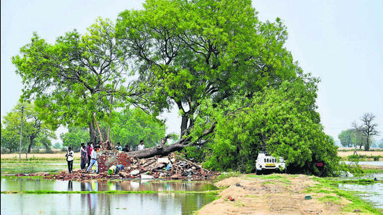
Pre-monsoon time to blame: IMD after mild warning fails in Delhi
Delhi faced an unexpected intense thunderstorm on Friday, recording 77mm of rain, marking its second-highest May rainfall in over a century.
If one were to follow the India Meteorological Department’s (IMD) forecasts from Wednesday onward, Delhi seemed in for a relatively mild spell of rain: a moderate thunderstorm on Thursday evening, followed by light rain or drizzle and winds up to 50 km/hr on Friday.

But what unfolded on Friday morning was anything but mild.
Also Read: Mother, three children dead as Delhi rain, storm wreak havoc
An intense thunderstorm swept across the Capital at dawn, catching the city off guard. Gusts reaching up to 80 km/hr lashed the city, accompanied by heavy rain. By the time IMD upgraded its forecast to a red alert on its website by 5am—warning of a “severe” thunderstorm and heavy rain—the storm was already in full force in parts of the city. Finally at 5.30am, IMD issued a press briefing, announcing the upgradation of its forecast to red alert.
Safdarjung, the city’s base station, recorded 77mm of rainfall by 8:30am—Delhi’s second-highest 24-hour May rainfall in over a century. The only time this was surpassed was on May 20, 2021, when 119.3mm fell due to the remnants of Cyclone Tauktae, officials said.
For Saturday, meanwhile, IMD has issued a yellow alert, forecasting light to moderate rain and gusty winds up to 40 km/hr, as a western disturbance begins to influence the region. On-and-off drizzle is expected from Sunday through Thursday, making for an unusually wet start to May.
IMD director general M Mohapatra said warnings for thunderstorms and squalls across northwest India had been issued up to five days in advance, but the intensity of such squalls can be hard to predict.
Also Read: Delhi sees chaos as rain, thunderstorms cause waterlogging, flight delays
“We had forecast a thunderstorm and gusty winds for Delhi, but the intensity was slightly higher than expected. During the pre-monsoon period, such storms can be highly unpredictable,” he said. He explained that last week’s heat created unstable atmospheric conditions, while moisture from both the Arabian Sea and the Bay of Bengal fed the storm system. The approaching western disturbance served as the final trigger.
Despite sunshine peeking through by noon, cool winds lingered. The maximum temperature settled at 29.1 degrees Celsius (°C) — 10 degrees below normal and a nearly 10 degree drop from the previous day’s 38.6°C.
“We saw a sharp drop of 7-10°C at most locations,” said senior IMD scientist RK Jenamani. “At Lodhi Road, the temperature fell from 28.2°C at 5:15am to 20.7°C by 5:30am. At Jafarpur, it dropped from 28.4°C to 19°C.”
The minimum temperature, too, plunged to 18.2°C, six degrees below normal. IMD said Saturday’s minimum is expected to be between 20-22°C, with the maximum hovering around 33-35°C.
Most stations in the city logged moderate to heavy rainfall. Palam recorded 45.6mm, Ridge 59.2mm, Lodhi Road 78mm, Pragati Maidan and Pitampura 71.5mm each, Ayanagar 39.4mm, Pusa 50mm, Jafarpur 67.5mm, and Najafgarh 40mm.
Wind speeds were equally dramatic. Safdarjung recorded a maximum of 80 km/hr at 5.10am. Pragati Maidan followed with 78 km/hr at 5.30am, and Palam recorded 74 km/hr at 5.19am.
Until Friday, Safdarjung had only logged 10.2mm of rain since January 1, making this deluge an anomaly. With just this single event, Delhi surpassed its average monthly rainfall for May, which typically stands at 30.7mm.
Mahesh Palawat, vice president at private forecaster Skymet, said intermittent rain would likely persist for the next four to five days. “This will keep the maximum temperature in the mid-30s. It is unlikely Delhi will touch 40°C this coming week,” he said.
Meanwhile, the downpour offered temporary relief on another front. Delhi’s air quality index (AQI) stood at 145 (moderate) at 4pm—down from 184 the same time the previous day. Forecasts suggest the AQI will remain in the moderate range for the next three days.
What Friday’s storm made clear, however, is that even in an age of advanced forecasting systems, nature still holds the power to upend the best-laid projections.
Stay updated with all top Cities including, Bengaluru, Delhi, Mumbai and more across India. Stay informed on the latest happenings in World News along with Delhi Election 2025 and Delhi Election Result 2025 Live, New Delhi Election Result Live, Kalkaji Election Result Live at Hindustan Times.
Stay updated with all top Cities including, Bengaluru, Delhi, Mumbai and more across India. Stay informed on the latest happenings in World News along with Delhi Election 2025 and Delhi Election Result 2025 Live, New Delhi Election Result Live, Kalkaji Election Result Live at Hindustan Times.


