Shops at Sarchu, Shinku La stir fresh border row between Ladakh and Himachal
Fresh row erupts as businesses from Ladakh set up shops in Himachal's border area. Dispute over Sarchu and Shinku La heightens, with both sides claiming territory. HP govt to raise issue with Ladakh admin and Centre.
A week after businessmen from the union territory of Ladakh pitched tents inside the Himachal’s boundary, a fresh row has erupted over the interstate border in Sarchu and the 15,800-ft high Shinku La.

Businesses from the UT have now set up make-shift shops and eateries on the Darcha–Shinku La Road and Zanskar–Leh Road, with locals claiming that the owners’ shops have come 13-18 km into Himachal at Sarchu and Shinku La.
Ladakh, meanwhile, claims its territory extends up to Palmo, the last village of Lahaul and Spiti towards Zanskar which is 10 km from Shinku La.
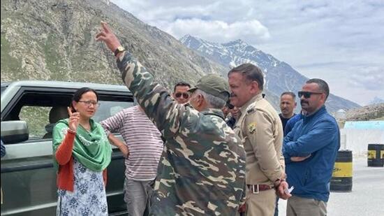
Recently elected Lahaul and Spiti legislator Anuradha Rana, local panchayat pradhan and other officials on Monday visited the disputed area and asked the businessmen to remove their shops. Forest department officials also served notice to locals from Zanskar running Dhaba on the Darcha Shinkula road to vacate the land.
“For the time being, we have removed the encroachments, but the government is resolving the long-standing interstate boundary disputes,” Anuradha Rana said.
HP govt to raise issue with Ladakh admn, Centre
After the fresh row, the Himachal government has decided to raise the issue with the Ladakh administration.
Revenue minister Jagat Singh Negi said, “There has to be a permanent settlement to the dispute, the land between the two sides has already been demarcated by the Geological Survey of India. The government will once again raise the issue with the administration of the adjoining UT as well as with the home ministry.”
“Ironically there has been little response from the other side’s administration. Every year, they do something to assert their position. Himachal sent a case for forest clearance under the FCA for the construction of Shinkula tunnel,” he said.
The row between the two sides erupted for the first time in 2013 when the Jammu and Kashmir Police set up a temporary post 13 km inside Himachal’s boundary at Sarchu from the boundary pillar.
After the dispute in 2013, Lahaul and Spiti as well deputy commissioners carried out a joint spot visit during which Himachal authorities presented revenue records and indexed sheets of Survey of India as evidence to buttress its claim on the territory. The records presented revealed that the boundary was 12-13 km ahead of the disputed point and both sides agreed on a demarcation. There is also an unfinished gate at the site of the inter-state boundary along the highway, which is reflected in the Survey of India maps, a revenue official said.
Jammu claims Churah, Ladakh Sarchu, Shinku La
Jammu has been claiming its right over Churah in Chamba district while Ladakh claims Sarchu in Spiti valley, 13 km into Himachal.
The former has even constructed a 10-km road within the limits of the Chamba, which resulted in an impasse between Chamba and Doda administration.
Last year, Ladakh claimed grazing rights over the pastures in Shinku La. A high-level meeting took place last January to settle the dispute; but the UT administration placed pre-independence revenue records to stake its claim over the disputed boundary at Sarchu and Sumdoh. Himachal too placed old records to claim that the local shepherds have grazing rights in Shinku La.
HP seeks demarcation according to maps
The Himachal government throughout the dispute has maintained that boundaries be demarcated according to the relevant maps prepared by the office of the survey general of India.
Himachal and Ladakh have disputed the boundaries before the National Commission for Scheduled Tribes meetings in 2015 and 2016 and demarcation by the Survey of India was ordered. Officials from both sides, however, have never shown any disagreement with the use of these maps for the demarcation of the boundary.
The Survey of India substantiated Himachal’s claim on the territory but no resolution to the issue was found as officials representing the then Jammu and Kashmir government rejected the validity of the maps presented by officials of the surveyor general of India.
Officials of the Ladakh administration have also rejected the demarcation done by the Survey of India in 1984 and the validity of the maps used by the Surveyor General of India.


