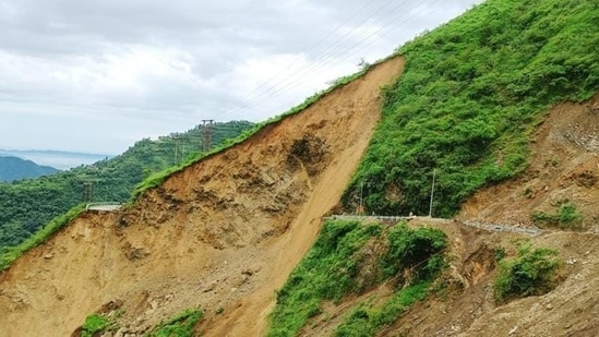
Landslide failures detection and mapping using synthetic aperture radar
The study has been authored by Alessandro Cesare Mondini and others.
Landslides are geomorphological processes that shape the landscapes of all continents, dismantling mountains and contributing sediments to the river networks. Caused by geophysical and meteorological triggers, including intense or prolonged rainfall, seismic shaking, volcanic activity, and rapid snow melting, landslides pose a serious threat to people, property, and the environment in many areas.

Given their abundance and relevance, investigators have long experimented with techniques and tools for landslide detection and mapping using primarily aerial and satellite optical imagery interpreted visually or processed by semi-automatic or automatic procedures or algorithms. Optical (passive) sensors have known limitations due to their inability to capture Earth surface images through the clouds and to work in the absence of daylight.
The long persistence of clouds in the monsoon seasons can then hamper the possibility of implementing continuous mapping systems in areas like Darjeeling, or Nilgiris, India where the Landslide multi-hazard risk assessment, preparedness and early warning in South Asia integrating meteorology, landscape and society (LANDSLIP) project deployed prototype early warning systems for rainfall induced landslides. The alternatives are active, “all-weather” and “day-and-night”, microwave radar sensors capable of seeing through the clouds and working in presence and absence of daylight.
We review the literature on the use of Synthetic Aperture Radar (SAR) imagery to detect and map landslide failures – i.e., the single most significant movement episodes in the history of a landslide – and of landslide failure events – i.e., populations of landslides in areas ranging from a few to several thousand square kilometres caused by a single trigger.
We examine 54 articles published in representative journals presenting 147 case studies in 32 nations, in all continents, except Antarctica. Analysis of the geographical location of 70 study areas shows that SAR imagery was used to detect and map landslides in most morphological, geological, seismic, meteorological, climate, and land cover settings. The time history of the case studies reveals the increasing interest of the investigators in the use of SAR imagery for landslide detection and mapping, with less than one article per year from 1995 to 2011, rising to about 5 articles per year between 2012 and 2020, and an average period of about 4.2 years between the launch of a satellite and the publication of an article using imagery taken by the satellite. To detect and map landslides, investigators use a common framework that exploits the phase and the amplitude of the electromagnetic return signal recorded in the SAR images, to measure terrain surface properties and their changes. To discriminate landslides from the surrounding stable terrain, a classification of the ground properties is executed by expert visual (heuristic) interpretation, or through numerical (statistical) modelling approaches.
The existing knowledge on landslide processes and the current technological capabilities are adequate to design, implement, and manage landslide detection and mapping services operating in the test areas of the project. The unique abilities of microwave radar sensors make SAR sensors particularly well suited for the rapid detection and mapping of landslides caused by large events, when timely information on landslide occurrence is required e.g., for rescue operations and emergency management, as well as to construct multi-temporal landslide inventories
Despite 26 years of undisputed progress, a number of theoretical, research, and operational challenges remain to be faced for the effective use of SAR imagery for landslide detection and mapping. For the challenges to be met, standards and shared best practices are needed to assess and hopefully reduce uncertainty, ensure repeatability and reproducibility, avoid misinterpretation and facilitate comparisons.
The study can be accessed by clicking here
(The study has been authored by Alessandro Cesare Mondini and others)
All Access.
One Subscription.
Get 360° coverage—from daily headlines
to 100 year archives.


HT App & Website


