Weather Bee: Western disturbances decreased India’s snow pack deficit in March
With around 50% deficit in the wettest hilly states and UTs, it is clear that western disturbances were not strong enough in the past month.
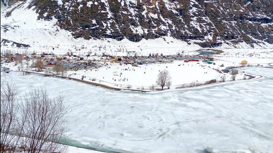
Western disturbances – storms originating west of India, usually in the Mediterranean region – that affected India’s northern states in March did not just cool temperatures in that part of the country. They also led to a big spike in the amount of snow accumulated in India’s northern states in the month, an HT analysis of satellite data shows. However, so far, this has not erased the deficit in snow built up in January and February completely.

The snow pack of India’s hilly states in the north is important for several reasons. Apart from replenishing rivers, it also acts as temperature regulator for India’s northern half. This is because winds blowing from the hills are often responsible for cooling temperatures in northern states at this time of the year, when northern India is not rainy. Moreover, snow also reflects sunlight and is responsible for maintaining earth’s energy balance. This is why it is important to track snow pack.
Data for snow pack is available from NASA from October 2000. The average of the first 20 years of the data shows that the snow pack of India’s hilly states in the north starts building in October, peaks in late April, and then declines up to September. The 2024-25 cycle began with a record low snow pack. From October 1 to January 4, the snow pack remained at its lowest level for those dates every day. With brief interruptions, when the rank rose to being second lowest for the date, this trend continued up to March 15. However, in the 24 days from March 16 to April 8 (latest available data), the snow pack of the ongoing cycle was ranked third lowest on 14 days and fourth lowest on four days, suggesting an improvement.
To be sure, ranks can sometimes be misleading. If no year had a deficit in snow pack in a particular part of the cycle, even surplus snow pack can be ranked low. Therefore, it is important to also look at deviations from past averages. A comparison with the average for the seasons starting 2000-01 and ending 2019-20 shows that the season started with a 19% deficit in snow pack. This increased almost steadily to a 26.4% deficit on February 24. However, with western disturbances striking after February, the deficit decreased. The deficit was back to the 19% level seen at the beginning of the cycle by March 16. To be sure, while the rank of the snow pack improved after March 16, the deficit has increased back to 23% by April 8. This is why heat waves have spread to places such as Delhi by April, instead of being confined to drier regions further west, such as Rajasthan and Gujarat.
Does the divergence in the improvement in rank and deficit in March mean something? It suggests that snow accumulation has consistently become poor in the second half of March, when it is building up to the annual peak.
Is the poor accumulation of snow in March because western disturbances have become less frequent than in the past? Drawing such a correlation between western disturbances and snow pack would be meaningful if western disturbances were the only factor driving the accumulation of snow. However, these storms can at best provide the water content for snow. In a warming climate, that water may not turn to snow.
To be sure, one HT analysis – published in February 2024 – had shown that western disturbances are not completely irrelevant to snow accumulation. While the number of western disturbances affecting India in March has increased (at least up to 2022, the last year for which this data is available), their strength may have decreased. The latter trend was seen in the precipitation data published by the India Meteorological Department (IMD).
This also explains why frequent western disturbances in March this year was not enough to erase India’s snow pack deficit completely. For the period from March 1 to April 10, Uttarakhand received the usual amount of precipitation (66 mm compared to the long period average or LPA of 67.2 mm) and Ladakh around 8 mm more than the LPA of 4.5 mm; but Jammu and Kashmir and Himachal Pradesh, which are wetter than the former two at this time of the year, received just around half the usual precipitation. Jammu and Kashmir received 94.1 mm precipitation compared to the LPA of 188.8 mm, and Himachal Pradesh has received 75.7 mm precipitation compared to the LPA of 136.3 mm.
With around 50% deficit in the wettest hilly states and UTs, it is clear that western disturbances were not strong enough in the past month. Their frequency may have offset some deficit, but that will have to continue to make up for the weakness.
All Access.
One Subscription.
Get 360° coverage—from daily headlines
to 100 year archives.


HT App & Website


