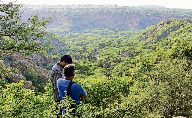
Discrepancy in Aravalli terms may reduce Gurgaon’s forest cover
While the Haryana and central governments are trying to clearly define the nature of the Aravallis, most revenue records mention the ranges as ‘gair mumkin pahad’ or ‘bhood’— land on which development activities can be carried out.
While the Haryana and central governments are trying to clearly define the nature of the Aravallis, most revenue records mention the ranges as ‘gair mumkin pahad’ or ‘bhood’— land on which development activities can be carried out.

Revenue records show that the forests in this region are categorised as ‘gair mumkin pahad’, foothills and ‘bhood’. Forest department officials say ‘gair mumkin pahad’ refers to areas where the topography does not permit cultivation and revenue generation. Generally, these categories are not accepted as forests and large sections are diverted for other activities.
A large part of Aravalli ranges fall in Gurgaon, which has already lost 50% of its total forest cover in the past two decades to urbanisation according to revenue records. Environmental activists claim the actual figure is a lot higher.
Forest department’s records show that the Aravalli hills and foothills occupy less than 9% of southern Haryana’s geographical area (encompassing Mewak, Faridabad, Mahendragarh and Gurgaon). If these areas are removed, following changes in Aravalli’s definition, the total actual forest area remaining will be less than 0.3%.
At present, Gurgaon has 1,619 hectares of protected forest area. This is 4% of the city’s total area, show forest department records. Of this, about 130 hectares have been diverted for various purposes.
“We have records where the civic bodies have converted forest land into gair mumkin hospitals, gair mumkin animal shelters and gair mumkin road. These discrepancies lead to creation of false records”, said a forest official.
With already low forest cover and repeated attempts at reducing forest areas under Aravallis, Gurgaon may soon have less than 1% forest cover, according to the department’s estimates.
“If the areas protected under PLPA including the foothills and grasslands are excluded from the forest category, the total forest area in southern Haryana would be about 0.3%. At present, Gurgaon has 4% forest area and 96% area is still free for developmental work. How can such a small path of forest cover create problems in planning? Even National Capital Region Planning Board has directed all states to have 20% forest cover,” said MD Sinha, conservator of forest, Gurgaon.
Environmentalists were of opinion that reducing forest cover at this rate is a recipe for urban disaster. “The entire exercise of converting forest cover for other developmental work is not acceptable in a state where green area is almost nil,” said environmentalist Vivek Kamboj.
Important Details:
Total area of Gurgaon: 73,880 hectares
Total protected forest area: 1,619 ha
Forest area diverted for other activities: 130 hectares
Forest department estimates that Gurgaon may soon have less than 1% forest cover, if forest areas under Aravallis reduced
Stay updated with all the Breaking News and Latest News from Mumbai. Click here for comprehensive coverage of top Cities including Bengaluru, Delhi, Hyderabad, and more across India along with Stay informed on the latest happenings in World News.
Stay updated with all the Breaking News and Latest News from Mumbai. Click here for comprehensive coverage of top Cities including Bengaluru, Delhi, Hyderabad, and more across India along with Stay informed on the latest happenings in World News.


