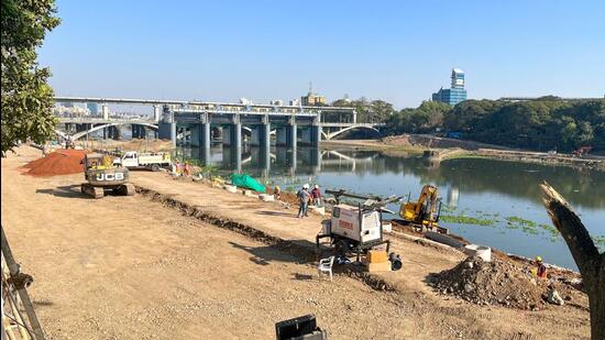
Researchers from IISER flag flood risk, climate oversight in riverfront project
Study by researchers at IISER Pune has raised concerns about flood resilience and climate preparedness of Mula-Mutha riverfront development project undertaken by Pune and Pimpri-Chinchwad civic bodies
Pune: A study conducted by researchers at the Indian Institute of Science Education and Research (IISER) Pune has raised concerns about flood resilience and climate preparedness of the Mula-Mutha Riverfront Development (RFD) project undertaken by the Pune and Pimpri-Chinchwad civic bodies.

Authored by Argha Banerjee, Radhika Mulay, and Tresa Mary Thomas from IISER’s Centre for Water Research (CWR), the report highlights multiple lapses in the project’s foundational design. Chief among them is the underestimation of future flood levels and the failure to incorporate climate change projections into planning. The report was published on April 29, 2025.
The RFD project, jointly executed by the Pune Municipal Corporation (PMC), Pimpri Chinchwad Municipal Corporation (PCMC), and Pune Cantonment Board, proposes a 44-km-long twin embankment aimed at flood control, beautification, and public recreation along the Mula and Mutha rivers. However, the IISER review warns that the current design may leave the city vulnerable to extreme weather events.
“The extreme monsoonal rain can lead to floods, when the river levels and the storage in dams are already high. This was not considered in the RFD estimates of flood levels. It may be prudent to consider the combined effects of the average monsoon discharge and the discharge due to the extreme rainfall. In addition, a strong gradient in the rainfall from the Western Ghats to Pune, together with the sparse network of hydrometeorological stations in this catchment, makes all the above flood estimates inherently uncertain,” the study stated.
Yuvraj Deshmukh, projects incharge, PMC, “While preparing the detailed project report, the data of last hundred years was considered. The civic administration has received requisite permission from authorities related to the project.”
Civic activist Sarang Yadwadkar, who shared the report with the media, said, “The study confirms what experts have been warning for years — the flood levels assumed in the project are dangerously low.”
The report explains that conventional flood management strategies rely on a 100-year return period model, assuming a major flood occurs once in a century. But with intensifying climate change, such events are expected to occur multiple times within a single century across South Asia, including India. This increases the likelihood of unprecedented flood damage, which could rise up to 20-fold in economic and social terms, the report notes.
It also highlights that despite having their own flood discharge estimates, the RFD team opted to use figures from the irrigation department that are 20–30% lower. Furthermore, a recent study by the Maharashtra Engineering Research Institute (MERI) shows higher discharge estimates, indicating a potentially serious design flaw.
The IISER researchers caution that the current flood estimates do not account for scenarios where heavy monsoonal rains coincide with already elevated river and dam levels — a situation increasingly common in recent years.
“Designing for significantly higher flood levels is not just advisable — it’s imperative,” the study stated, urging that Pune’s existing scientific institutions such as IISER, Indian Institute of Tropical Meteorology (IITM), and India Meteorological Department (IMD) be engaged in a thorough reassessment of the flood risk model.
The study also questions the environmental sustainability of the project. It notes that 240 hectares of green cover are slated to be replaced with concrete embankments, with no clear assessment of the project’s carbon footprint or ecological impact. The report calls for an independent evaluation of the Environmental Impact Assessment (EIA) by local scientists and subject experts.


