Monsoon enters third break, little rain in store for Delhi till August 28
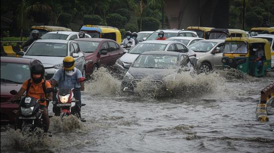
Delhi received the season’s heaviest spell of rain on August 21 (138.8mm), which was also the most rain in a single day of the month since 2007.
After a spell of intense rain over the weekend, the monsoon on Wednesday entered a break phase, the third this season, a frequency that weather experts said is unusually high for the city, and the Met office said that temperatures are now likely to rise above normal on the back of the dry spell, likely to last till August 28.

“Even after August 28, only scattered or patchy rainfall is likely, because no intense pressure system is seen building up to trigger good rains in Delhi and surrounding regions,” said a senior official of the India Meteorological Department.
The official added that in the absence of rainfall, temperatures are likely to remain high.
On Wednesday, the Safdarjung observatory, considered representative of Delhi’s weather, recorded a maximum temperature of 36.4 degrees Celsius, three degrees above the season’s normal. The minimum settled at 27.4°C, a notch above the season’s average.
Experts said the monsoon in Delhi usually has just two break spells for about 4-5 days each.
“This is an uncommonly high number of dry spells,” said Mahesh Palawat, vice-president of Skymet, a private forecaster.
IMD scientists define weak monsoon conditions as those when the end of the monsoon trough shifts to the Himalayan foothills, even as eastern India receives ample rainfall.
A complete or a typical break is when the entire Indo-Gangetic plains and central India experience dry spell at the same time.
The monsoon first hit a dry spell between June 29 and July 12, even before it made its onset in the Capital. It eventually hit the city on July 13, over two weeks behind schedule, and the latest since 2002.
However, just two intense spells covered the month’s rain deficit, with July ending with surplus rainfall.
The monsoon then hit another dry spell, resulting in few showers for the first two weeks of August, with the month receiving less than half the rainfall it usually gets in that period. The monsoon revived on August 20, followed by the season’s heaviest spell of rain so far on August 21 (138.8mm), which was also the most rain in a single day of the month since 2007.
Madhavan Nair Rajeevan, secretary of the Union ministry of earth sciences, also said such partial breaks occur every season, they have been more “prolonged” this year.
“The warming of the Indian Ocean at a higher rate may be one of the factors. Another factor could be the Madden-Julian Oscillation, or MJO location is unfavourable and is inhibiting convective activity,” said Rajeevan.
MJO location is the largest element in the intra-seasonal variability in the tropical atmosphere and strongly regulates features like low pressure systems over the north Indian Ocean. MJO is an eastward moving disturbance of clouds, rainfall, winds that affects weather activities (such as storm, rainfall) across the globe.
Experts said the monsoon in northwest India has seen the weakening phase more frequently.
“The break spell is not noticeable sometimes, as it lasts for just two or three days. One of the major reasons for the weak conditions is that both the frequency and intensity of the weather systems (low-pressure systems) formed in the Bay of Bengal this monsoon is low,” said Palawat.


