Weather Bee | The avalanches, landslides, mudslides, and shooting stones in northern states explained
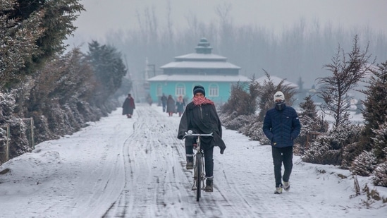
This past winter, India’s hilly states recorded the lowest-ever snowpack since October 2000. This could decrease the water supply to rivers in the months ahead
The 2023-24 winter – the season runs officially from December to February for India – was an exceptionally warm one. For example, by minimum temperatures, it was the ninth warmest in India since the 1951-52 winter, the earliest year for which the India Meteorological Department (IMD) has created gridded data for temperatures. A fallout of this was that India’s hilly states recorded the lowest-ever snowpack in satellite records since October 2000 almost throughout the season, which could decrease water supply to India’s rivers in the months ahead.

Does the end of the official winter season mean that there is no room for improvement left?
The intuitive answer to the question above is no. However, that is not the case in reality. One reason for this is that the official winter may not be the statistical winter everywhere in India. The average maximum and minimum for India is indeed the lowest usually during the December-February season, which makes India’s official winter also the statistical one. However, this is not necessarily the case for all states, as HT explained here, and may not be the case even within large states with diverse geographical regions.
There is another reason why the end of India’s official winter does not mean that the snowpack in its hilly regions cannot grow. HT analysed the average snowpack during 2001-2020 over India’s hilly states as measured by snow water equivalent (SWE) or the water content of snow. This shows that India’s hilly states reach their peak snowpack only on April 20. This means that there is still around six weeks of time for India’s snowpack to grow.
To be sure, as the maps below show, the average snowpack HT calculated is for a rectangular region slightly bigger than the political boundaries of the hilly states. These maps also show that the region over which there is snow is very different in January (India’s coldest month usually) and April (the month of peak snowpack). While there is some snow in even lower reaches of India’s hilly states in January, it is limited to the upper reaches in April. The reason why the average snowpack of the region reaches its peak in April is that snow becomes much thicker in April in the upper reaches than in January.

These statistics suggest that at least India’s overall snowpack can still grow and feed India’s rivers. However, this is only a partial relief. As of March 4 – the latest data available from satellites – the snowpack over India’s hilly states was still the second-lowest since 2001. Compared to the 2001-2020 average, the snowpack on March 4 also had an 18.2% deficit.

While this is an improvement compared to the over 20% deficit prevailing every day from December 31 to March 1, the quick and late improvement also extracted some cost. There were reports of avalanches, landslides, mudslides, and shooting stones from at least Jammu and Kashmir and Himachal Pradesh in the past week.
These statistics taken together mean that while India’s snowpack can still grow for some time, filling up the deficit quickly will likely lead to disasters. This makes the bargain between good snowpack for plains (so that rivers feeding plains have sufficient water) and good snowpack for hills (so that there are no deadly avalanches at least) particularly difficult this year.
Abhishek Jha, HT’s senior data journalist, analyses one big weather trend in the context of the ongoing climate crisis every week, using weather data from ground and satellite observations spanning decades.
All Access.
One Subscription.
Get 360° coverage—from daily headlines
to 100 year archives.


HT App & Website


